


Hurricane Dorian Heading Towards Florida; Local Impacts Remain Unknown
Thu, Aug 29, 2019 |
 |
|
Hurricane Dorian continues to strengthen in the Atlantic Ocean and is set to hit Florida as a major Category 3 hurricane on Monday.
|
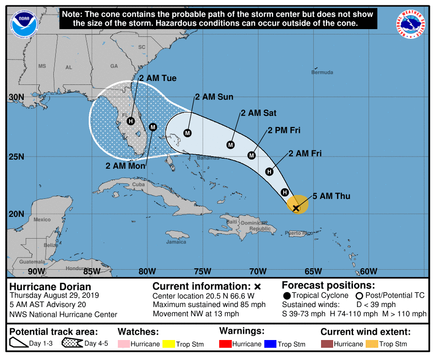
As of Thursday morning, Hurricane Dorian was a Category 1 hurricane with maximum sustained winds of 85 mph. The storm located about 150 miles north of San Juan, Puerto Rico was moving northwest at 13 mph on a direct path towards Florida.
As the storm turns in the Atlantic it is expected to rapidly intensify to a Category 3 hurricane and slam Florida sometime early next week as one of the most powerful hurricanes to impact central Florida in several years. The exact point of landfall is unknown as of yet, but forecasters expect the storm may make landfall somewhere between Daytona Beach and Cape Canaveral. However, the exact point is unknown and a cone of uncertainty extends from the Florida Keys to South Georgia as a possible point of landfall.
The storm is then expected to move over central Flordia. After that point, the forecast is still too far out to make an accurate assumption of what Dorian would do. Some models show it turning north and heading up the east coast. Others show it going into the Gulf of Mexico and possibly turning north and heading into the Peach State.
If Dorian were to take the northern turn after entering the Gulf of Mexico it could increase rain chances in the Chattahoochee Valley by the middle part of next week. Forecasters are closely watching the storm which slammed the U.S. and the British Virgin Islands on Wednesday with wind gusts over 100 mph as it passed over the island nations.
We will keep our readers updated on any changes to the forecast and possible impacts Dorian may carry as its path becomes more certain.
")
")